|
My interest in the River to River trail began in 1996. I had done a lot of reading on the Appalachian Trail and Pacific Crest Trail and long distance hiking in general. I knew of the hilly and beautiful terrain of Southern Illinois, having toured the area previous spring. At an estimated 148 miles in length, a thru hike seemed like a challenging yet realistic goal.
I prepared equipment and menu lists, poured over maps, carefully plotting out my intended course. Unfortunately I had no money and was too busy with work and school to make the trek. I shelved the project and put all my notes and maps in storage, still with the intention of someday giving it a shot. Five years later, in late 2001, I finally envisioned an opportunity to make the hike. I set aside 14 days in February 2002(later changed to March 2002) for a thru-hike, and dragged out the old maps.
The next few months so was spent gathering equipment and information. I had gained some experience backpacking and had a good grasp of what would be required to make the haul. It turns out a lot had changed with the trail itself since 1996. A non profit organization, the River to River Trail Society, had formed and was doing maintenance work and trail routing in conjunction with the US Forest Service. This resulted in a number of routing changes and improved trail quality and marking, as well as much easier access to information and maps compared to what I had faced in 1996. The trail now measured 160-170 miles in length and had been re-routed off many of the roadways it had initially followed.
By February, I had most of the necessary food and equipment, and was finalizing all the logistics involved. I did a few snowy shakedown hikes with a full pack to get conditioned. Finally it was time to go.
My brother stayed at my place in Champaign Saturday night. Sunday morning around 4 we each left in our separate cars for Devil's Backbone Park in Grand Tower, IL. The plan was for us to meet at the park, I would leave my car there and then he'd give me a ride to the eastern terminus of the trail, Battery Rock. Things went as planned, and we arrived at the banks of the Ohio River just after noon. Watching his truck drive away, I set off in perfect weather. Only 170 miles to go . . .
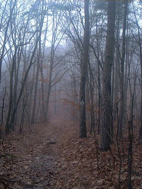
I actually started just north of Battery Rock on a muddy edge of the Ohio River, the site of a few houses and trailers. From here I bushwhacked up onto the bluffs along the river, which provided some excellent views. I couldn't determine if I was on top of Battery Rock or still to the north of it. I cut into the forest at an abandoned shack and hit an overgrown roadbed, which eventually led me to a field, and later a gravel road which was part of the official trail.
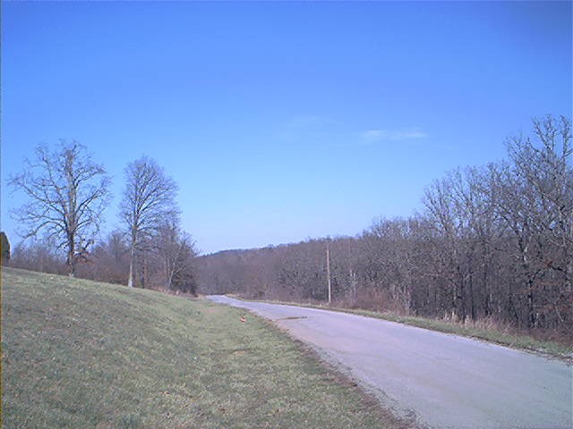
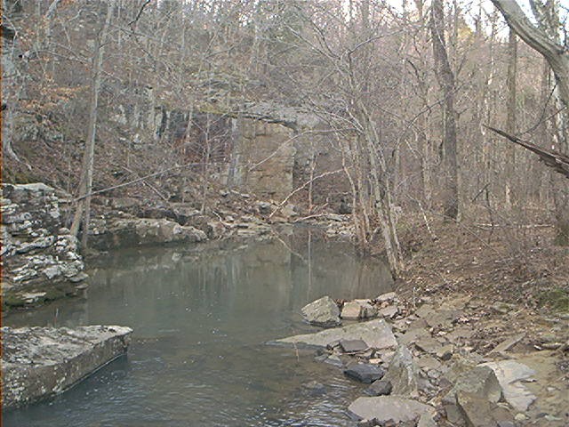
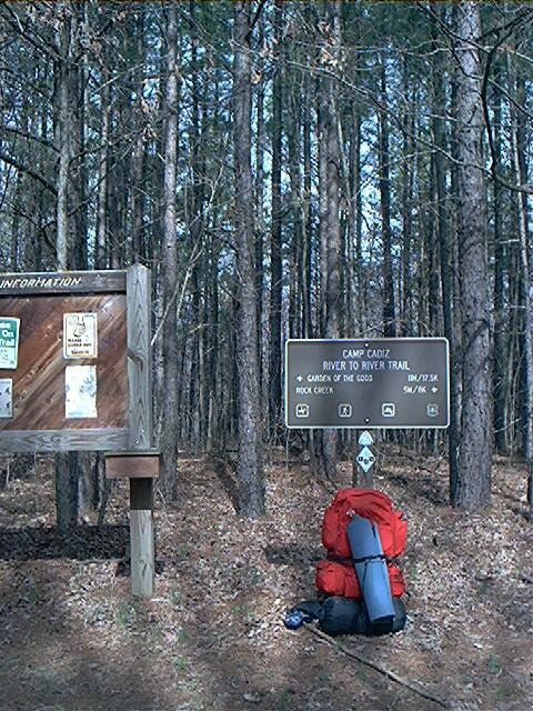
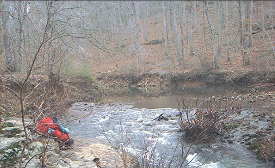
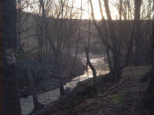
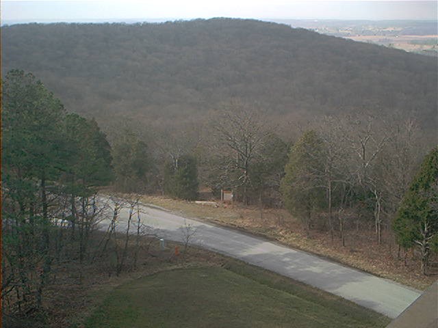
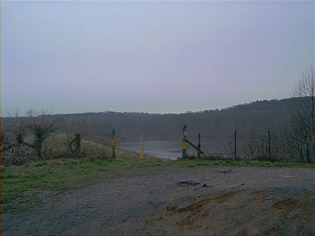
I arrived at the collection of old houses known as Lamb and then headed up Belt Hill, which was the first of what would be countless inclines on the trail. From here it was more road hiking to IL route 1. At Mt Zion Church, the trail follows a gravel road uphill to Mt Zion Cemetery and continues to Rock Creek after a number of miles. I encountered a few local farmers on this section, who were knowledgeable about the trail, and seemed unimpressed of my goal to hike the entire distance. I got to the Rock Creek spur trail around 4PM and set up camp at a remote location in the Rock Creek ravine. My pace was great, 15 miles in 5 hours, but I was still fresh, this was by far the easiest section of the trail.
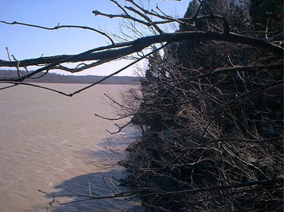
Ohio River near Battery Rock
| 
Mt Zion Cemetary
| 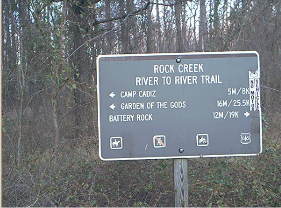
Rock Creek Sign
|
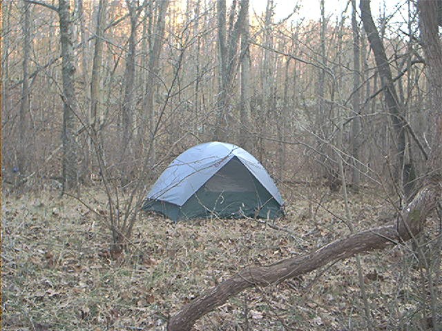
Campsite at Rock Creek
| 
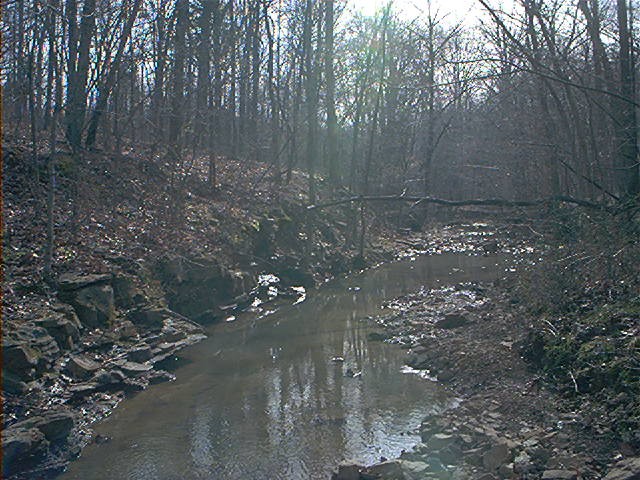
Rock Creek
|
After a calm night, I awoke to my alarm clock at 5AM, the temperature reading at 23 degrees. The water bottle had frozen up, so I filtered some more water, had some instant breakfast, and packed up my gear. My shoulders and feet were pretty sore. Hit the trail after sunrise and was looking forward to do some off-road hiking for a change. I was hoping to at least get to High Knob by the end of the day, and if things went really well, arrive at Garden of the Gods, where I could use the developed camping facilities.
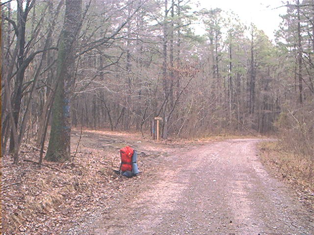
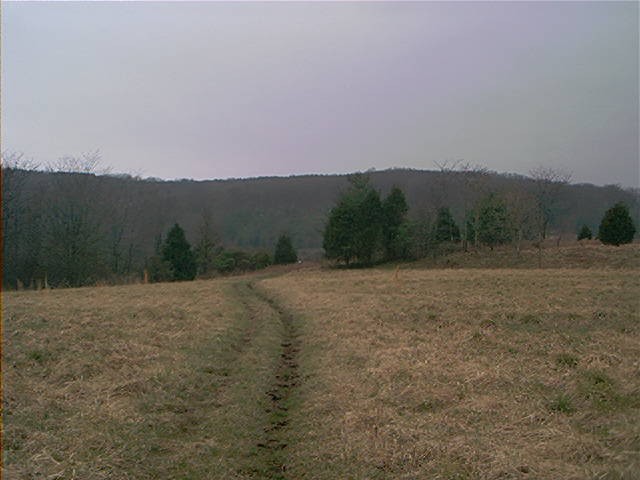
The first destination was CCC project Camp Cadiz, about five miles to the north. I passed to the north of the ghost town of Rock Creek, found the trailhead to Cadiz. This section was hiking on old roadbeds and connector trails. I saw a large group of deer darting through grassland, I counted at least 8 of them. The trail became rockier and started a pattern of descending into creek beds and then gaining the ridge. After walking along a final wooded ridge, I hit a forest service road and Camp Cadiz, which was completely empty. It was mid-morning and it had warmed up considerably, so I stripped off my upper thermal and continued on.
The next section of trail was to pass McPherson Cemetery and Karber's Ridge Blacktop on the way to High Knob. The topography was a little gentler than the section just before Cadiz, but the trail was muddy and rutted from erosion and horse travel. By mid-afternoon I got to the prominent High Knob. I took a short rest here and checked my map, eventually deciding to push on to Garden of the Gods. My entire body was beginning to ache, especially my unconditioned shoulders from the forty pound pack. There were a number of great overlooks to the south near the Buzzard's Point area. After another mile or so it was overcast and starting to get dark. Tired and annoyed, I was not in as good of physical condition as I thought, and no doubt in some sort of calorie deficiency from the last two days. I was bit confused as to where I was on the trail, but then spotted the entrance road to Garden of the Gods, and shortcutted by climbing directly up to the campground area, which sits on the top of bluffs. I took the first campsite I could find, collapsed for a while - so sore I could barely walk. I had beef stew for dinner and was in bed by 6. I estimated 19 miles for the day, but I'd expected to be in better shape than I was. I wondered what I had gotten myself into, how far I could make it.
Icy morning
| 
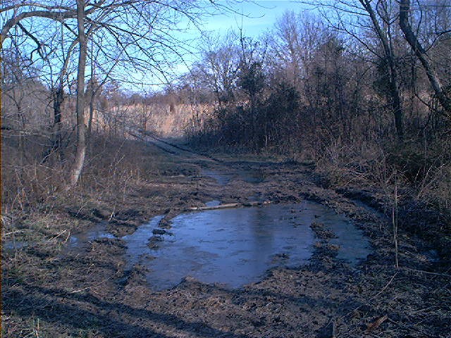
Bad section of trail
| 
Camp Cadiz
|
Trailhead at Cadiz
| 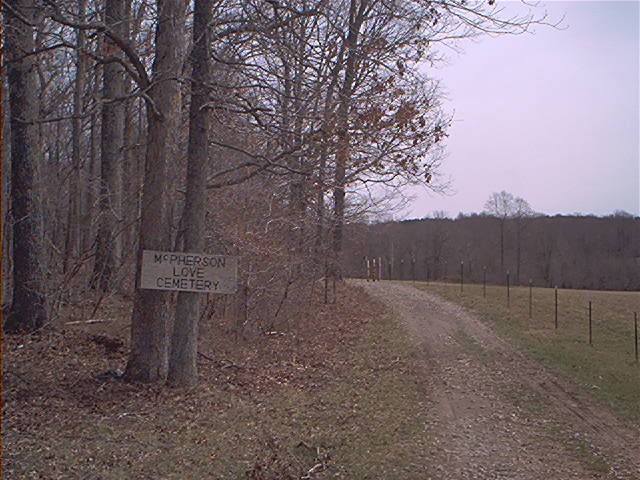
Road to cemetary
| 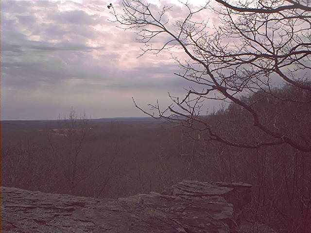
Buzzard Point?
|
It rained all night, but the tent held up pretty well. I woke up to a foggy mist and was on the trail by 7:30. Today's schedule was on to Herod, and then to One Horse Gap and camp at Lusk Creek. The six miles to Herod went through Garden of the Gods wilderness, a rugged collection of hills, valleys, and rock formations - very nice. The trail was well marked and fairly muddy. Mid-morning I got to Herod, a small town with a few churches, a post office, but no supplies. A local offered to give me a ride further down the road, an offer which I politely declined. From here it was south on Raum Road for a few miles, where the trail broke off to the south towards One Horse Gap. Most of this section involved hiking along an abandoned road on a ridge top, which was relatively easy, and provided good views on either side through the bare forest. From the roadbed, the trail broke off to the south - I briefly considered continuing on the old road which would intersect with the trail again in another couple miles - but decided to be a purist and stick to the trail. Moments later, staring at a major descent (and subsequent ascent), I threw that plan out the window and decided to bushwhack along the ridge towards One Horse Gap, in order not to lose my elevation. In retrospect a bad decision. It was rough, slow cross country travel, within enormous amount of deadfall to go over, and my pack getting snagged at every turn - this area would have been a total nightmare to deal with in the full growth of summer.
I never got to One Horse Gap, instead ending up at a spur trail heading north back up to the road bed at top of the ridge. From here it was a slightly downhill, very muddy mile and a half to Concord Cemetery. The trail followed a road for a short ways, crossed Concord Creek, and then headed up another rocky incline. I met another backpacker at Concord Creek, a graduate student on Spring Break. She was headed for Lusk Creek and eventually to her car at Circle B Ranch. Was one of the only people I saw all day. I was really moving at this point and passed her as I began up the incline. It was starting to get dark; time to find a place to camp. I descended into another creek basin, which was a wide valley with a maze of small ditches and drainages on either side of the winding creek. I set up camp along one of these small ditches, out of sight of the trail, in a very hidden little spot. It was a cozy site but had little room to move around, and if there were heavy rains in the night there could have been trouble. Had excellent freeze dried beef stroganoff for dinner. Tomorrow I hoped to get to Trigg Tower, or Bay Lake at the least.
Wet morning at Garden of the Gods
| 
Garden of the Gods Wilderness
| 
Herod
|
On the ridge S of Herod
| 
Exiting Concord Cemetary
|
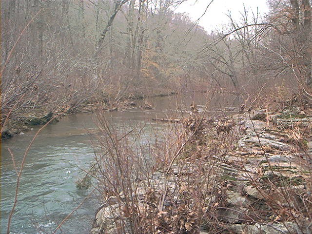
I slept until 7 and got going soon after. The route rose out of the drainage area I had camped in and descended back into the Lusk Creek ravine, trail condition was poor and the terrain was rough. This day, as in most days, I started slow, and by the time I got to Lusk Creek only a few miles away, I was already winded. Lusk Creek is a rocky, winding stream with a real wilderness character, worthy of a weekend or more of exploration. After successfully crossing the creek I stopped to filter some water, take some pictures, and to patch up my feet, which were already beginning to get pretty mangled. The weather was picture perfect, but I was in bad shape already and doubted I'd get very far for the day.
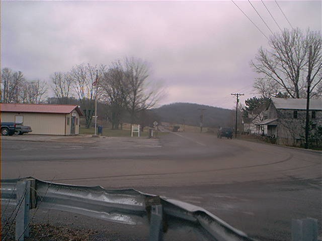
Trudging out of the valley and along a ridge I eventually reached a gravel road. From here the official trail heads west past the road, then south and intersects again with the road near Eddyville - I slightly shortcutted by taking the road south, past Circle B horse camp. I would often make these very slight shortcuts on the trail just to save my feet and give myself a breather from the almost perpetual up and down the trail hiking offered. From Circle B, it was roughly 3 miles of road hiking through agricultural fields to Eddyville. I arrived there around 11 or so. Eddyville was one of the bigger towns the trail passed through, but it really wasn't much; a bunch of old houses, small downtown area, a post office, and a diner near IL145 which was quite a temptation. I lost, then regained the trail through the town streets, and then headed west out of town. After being hassled by a few dogs at a house, the trail turned sharply north along a road to a dead end, and it was back into the wilderness again.
This next section of trail followed a ridge, then ascended and descended into creek beds, providing some tough climbs. Erosion had gutted the path in many spots, making footing muddy and unstable. As I would find true for most of the trail, the dark brown mud was never a problem, but the tan colored mud/clay drove me crazy - it would only take a couple of steps to get my boots throughly caked - I'd scrape off the mud and then another couple paces the boots would be fully caked yet again.
The next landmark ahead was Crow Knob, and while it seemed not far on the map, it was quite a draining haul to get there. At this point I realized how easy it is to sit at a desk at home with maps and estimate a hiking daily distance, compared to actually having physically cover the distance. Conditions were warm and dry, so I broke out the shorts for the first time, and lashed a pair of wet socks on the back of my pack to dry. Crow Knob is marked off as a natural area by the Forest Service, and rightfully so. I would have liked to shed the pack and get a look from atop the rock outcrop, but rationing my time and energy, I decided to press on. I anticipated a short stroll to Cedar Grove Road but again it took longer than expected. It was getting pretty hot too. Somewhere at this point I veered onto some side trail and ended up south of the intended road junction - after some intense map reading I headed north up the road and picked up the main drag again.
The sun was getting lower on the horizon and I was running on fumes, beef jerky, and granola bars. The next section was flatter, a bit of a respite. I followed a fence line and a messy, disused dirt road, and then entered a conifer forest. Finally, the east edge of Bay Lake appeared far below, however it was another couple miles to the spillway to the west, where I planned to camp. Instead of following the blazes downhill towards Little Bay Creek, I followed a side trail which led uphill to a fantastic view of Bay Lake, right over the dam. I hiked down a steep incline to the lake as a man on an ATV impressively drove up the same incline.
I wanted to camp near the lakeshore but it was too wooded and steep. There was ripped up concrete at the south end of the spillway which was also inadequate. I settled on what look like a fishing camp below the dam, in a nice secluded yet trashy area. I wondered if I might get a visit from some young rowdy locals in pickups later in the night.
I set up the tent, ate, filtered water, and went to bed 'late' at around 7PM. My back muscles had toughened up, but my legs were still quite sore.Fell asleep immediately. 18 miles for the day.
Lusk Creek
| 
Lusk Creek
| 
Campsite near Bay Lake
|
Campsite near Bay Lake
| 
Below Bay Lake Dam
|
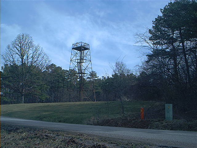
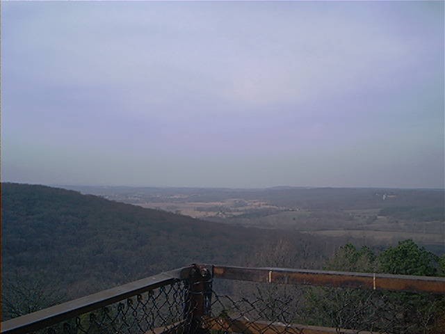
Left Bay Lake around 7:15, nearly fell in the drink at the stream crossing just below the spillway, then rejoined the main route and headed north, paralleling railroad tracks on the bluffs a hundred feet above. Today's goal was Dutchman Lake, 25+ miles, which would later prove a ridiculously ambitious objective. Weather was again perfect. I headed west over the railroad grade towards Trigg Tower Road, which I reached without too much trouble. Another shortcut was in order, so I followed Trigg Tower Road to Trigg Tower, it probably was a greater distance than the official trail but was an 'elevation gain/loss' shortcut. After passing a few farmhouses and encountering a road leveler doing his business, I arrived at a windy Trigg Tower, which was a highlight. Though the tower itself was only 4 stories high, the views from the top were spectacular in every direction.
The trail, as did the day, started to go downhill after that. I took a spur trail back to the RR trail, but unknowingly dropped my guidebook and maps along the way. Another couple miles later I stopped to tape up my feet yet again, and realized what had happened. Could I make it another ninety miles on 6 days of food without maps? Nah, too risky. I dropped the pack and backtracked towards the tower. The trail guide was - what else - brown, in a sea of leaves and dirt I knew it wouldn't take much to miss it completely. I luckily found it back along the spur trail, but the ordeal was frustrating.
Another few miles and the trail met up with Cedar Creek - here the painted "i"s seemed to direct me every which way, but the true trail went south over the bridge and then followed the creek and headed up a ridge. I decided to take another shortcut at the top of the ridge and head directly west towards the Simpson Blacktop, rather than follow the trail which curved back towards one of the branches of Cedar Creek. It proved to be a good decision, as the orchards were easy hiking and saved me some time and more importantly, wear and tear on the legs. This area turned out to be private property though. I ended up at some old barns, mobile homes, then someone's backyard and driveway where I riled up a black dog - luckily he was leashed up and I made it to the road without getting the homeowner riled up.
The trail hit Hilltop Road, the start of a long, steady climb. It was early afternoon and I was on a steady pace, aided by the shortcut. The next few miles were more uphill and downhill alterations with an eventual descent into Max Creek, where things got interesting. The trail got sketchy at the creek and I walked up, then back down to find the blazes, and a safe place to cross. I had crossed countless creeks without incident so far, but this time I slipped on a mossy rock and fell in on my side - fortunately I escaped injury and my pack remained fairly dry. Once across the creek, I could not find the trail, but followed the old blue "i"s painted on the trees, but I also saw white blazes indicating a side trail, along with a red blaze which I had no clue about. I proceeded to get pretty confused, while still on a trail I got the impression I was not on the correct route, but for some reason I decided to continue on. The next couple hours were spent following Max Creek north and west, then heading uphill and back to the south. I got spit out at an overgrown forest service picnic area and turn around, then hit a gravel road and regained my orientation. My guess is that I had taken an old River to River trail route, which went all the way north to Tunnel Hill at one time. It was a hot, dry, dusty road hike through deserted farmfields to US 45, which is the unofficial midpoint of the trail. I was tired and looking for a place to camp, but had to get away from the highway to public land and a water source.
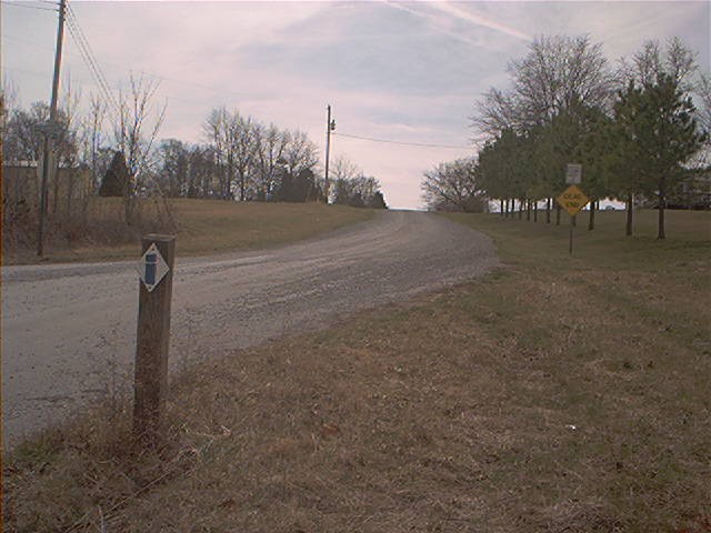
Walking along US 45 was unpleasant. Trucks were flying by at breakneck speed just a few feet away, but it was too muddy to walk in the drainage ditch. I recall seeing beer bottles and fast food wrappers strewn along the highway, and thinking I'd give anything for a burger at that moment. I arrived at Goddard Crossing, where the trail traversed a private drive and entered the backcountry. This next section was an easy, beautiful ridge hike with view on either side, the problem was I was becoming very dehydrated, I had been low on water since Max Creek and I hadn't encountered a creek to filter water since. Getting to a creek at this location would involve a major bushwack a long way downhill, so I numbingly pressed on. The trail kept following the ridge in a straight line, on and on and on. I passed one set of power lines, then another and finally bushwhacked not far down to a tiny creek. I filtered questionable water and drank excessively, the lower body was painfully sore and I could not will myself to continue. It was a primitive and remote camp spot, I couldn't really locate where I was on the map. Basically just a wooded ditch with a spot flat enough for the tent. Another hard day done.
Large railroad grade
| 
Trigg Tower
| 
Looking west atop the tower
|
Looking down at trailhead
| 
RR trail at Hilltop Lane and CR 4
|
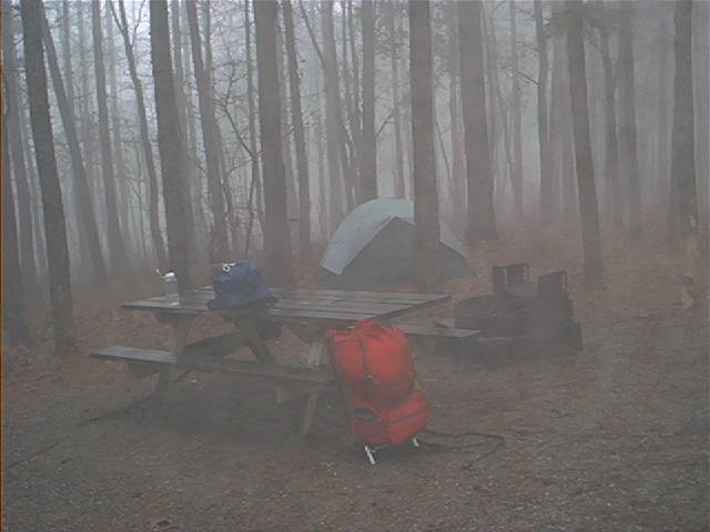
A day of two halves. Woke up early, around 6, had some Ramen Noodles. It had been a hot and humid night, but as I packed up and hit the trail the wind picked up - a front was coming through. Today's goal was Ferne Clyffe State Park. After passing Little Cache Lake #1, it began to drizzle, then eventually rain with occasionally heavy periods. At this point I broke out my low-tech pack cover - a garbage bag. It kept my pack dry for maybe five minutes. The rain intensified as I reached I-24, then receded as I walked along Dutchman Lake. The trail then headed up hill along a sportsmans club and back downhill to an old road grade which skirted the north edge of Gould Lake. The temperature had dropped dramatically at this point and I was shivering severely, so I put on my thermal and outerwear and continued to the blacktop. From here it was a determined haul along Tall Tree Lake Road north to IL 37. The rain was light but the winds were strong, blowing from the north right in my face. Despite all this I was making good progress. Mostly just sustaining movement to keep warm.
I got to IL 37, made another unpleasant highway hike north, and cut towards Ferne Clyffe at Rebman Lane. I was a few miles south of Goreville and was torn between heading north to rest and resupply, or continuing on to Ferne Clyffe. I kept going, and got to a hunters trailhead at the end of Rebman. I rested,used the outhouse, and walked north into Ferne Clyffe. I reached a park road and a horse camp, closed for the season. The main trail continued into Happy Hollow, but I cut up the road towards Ferne Clyffe Lake. I took a brief rest at a deserted backpackers camp, filled up my water bottles, and checked the time - it was only noon, and I had already gotten to the desired destination for the day. Should I try to go farther? I had quite a bit of energy but was sweaty and grimy, really wishing I could have a shower. I headed past the lake up to the developed campground, and to the shower building, where a sign said it would be closed until April 1st. I wanted to walk to the rangers office and beg him to open it up early. Instead I spent a while checking out the campground, trying to figure out what to do next.
It was too early to make camp, I could have easily made it to I-57 five miles to the west, but beyond that it would be at least another 10 miles of road hiking, meaning no public land to camp on. I decided to hike into Goreville in hopes of finding some supplies and maybe even a cheap motel. Here's where things started to go downhill. Taking a directional shortcut through Ferne Clyffe proved to be a mistake. Just too many cliffs. Beautiful area though. I intended to go directly north towards the town, but ended up making a big U down to a park road and some picnic areas at the cliff base. I followed a trail north at the end of the road and ended up surrounded by slippery limestone bluffs on three sides. I clumsily and with much effort climbed up one of them, passed some barbed wire and came out at a rich rural subdivision. I made it to Goreville, which appeared to be a typical small town. A desheveled mess, I walked through the residential areas, prompting barking from the local dogs, of which there seemed to be at least one in every yard.
At this point I was thinking maybe a motel was needed, because I really didn't think I'd have the energy to get back to Ferne Clyffe. I walked back to IL 37 at the main part of town, but I couldn't find any stores, food, supplies, or anything. I walked north past a bank, then headed back south, hoping I would find something. There was a gas station, but it was shut down. I continued south, and the highway headed out of town. The nicest commercial establishment I saw the whole time was a funeral home.
There have to be some stores in Goreville, right? I never encountered them, and wasn't going back north to find them. I decided to get back to Ferne Clyffe and camp. Good move. To get there, I decided to bushwhack southwest from IL 37 to the campground. Bad Move! Again, never shortcut through Ferne Clyffe. This time, there were thorns and brush everywhere, snagging my clothing and skin at every opportunity. It was a low morale point. Going was slow, and I got disoriented and ended up at the park maintenance area, which was to the south of the camp. had hiked into Goreville literally for nothing. Sure the scenery was nice, but I was more concerned with conserving energy, bodily wear and tear, and food, and in that respect the afternoon had been of no use. It was only 4PM. I got water, had spaghetti for dinner, and was relaxing by 5PM. I met a very nice park attendant, paid my camping fee, and chatted a bit.
The days mileage I estimated at 18 miles net, but closer to 23 or 24 with the Goreville detour included. I was really shot at the end of this day, but at this point I knew I would make it to Grand Tower. Besides, my car was there and I had no one to rescue me even if I needed it, so what choice did I have?
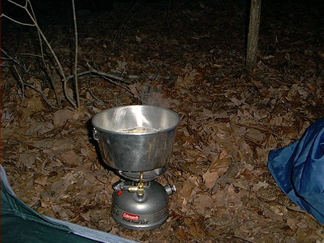
Breakfast!
| 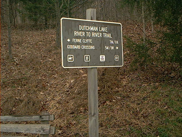
Dutchman Lake sign
| 
Dutchman Lake
|
Just past Dutchman Lake
|
The previous night I had gotten a marginal sleep - a thunderstorm had slowly rolled through, and while the rain and wind weren't too bad the lightning blasted my eyes open every few seconds it seemed. The goal for the day was Giant City State Park, 21 miles. It would be a haul, but by this point I'd gotten used to the grind.
I wanted to get an early start at 4, but slept "in" until 6. Soup for breakfast, then started hiking, heading towards the same picnic area at the cliff base I had encountered yesterday. The plan was to rejoin the main route at Sullivan Road, then break from the trail and head directly to Goreville Rd, and rejoin the official trail just east of I-57. The morning was overcast, and I made it to I-57 without incident. After precariously crossing an under-construction, one lane bridge amidst traffic, I encountered a gas station and food store - finally a chance to re-supply!! The station was recoginzable from a research trip I made the previous month but for some reason while hiking into Goreville the previous day looking for supplies I hadn't even considered it. I possessed enough meals, but was totally short on snacks and quick energy, so I stocked up on chips and candy and continued.
The next 7 miles were exclusively on roads, which was welcome, as it meant fast travel, easier inclines and a chance to accumulate some mileage early in the day. I had found and lost numerous walking sticks throughout the hike and along this stretch I found some good ones which I'd have for the duration. I cannot emphasize enough the importance of dual walking sticks(or trekking poles, their commercial counterpart). I had always thought they were gimmicks, but they are joint savers for long hikes. By this point I couldn't fathom hiking without their assistance.
Along the road hike, I chatted with a few locals and encountered roosters, chickens, and cattle. Arrived at Wayside, a "town" of two houses and a radio tower. I passed a friendly dog, more cattle, and made a sharp right(east), then a left(north) along a decaying roadbed as the trail headed towards Panther Den Wilderness.
Panther Den Wilderness was a very intersting area, certainly one of the highlights of the hike. The trail began along a fenceline, then headed north and descended into a creekbed consisting of a three-sided bowl of rounded, overhanging, rocky cliffs. Making a turn to follow the creek at the bowl, I could never actually figure out what was actually considered the "Panther's Den", but it could have been any of the rock overhangs on either side of the widening creekbed. I took a long rest in this area, taking in the scenery and solitude, thinking back to the days when American Indian tribes called this area their home. I would have liked to camp here had the timing worked out. Eventually the trail climbed out of the creekbed along side a pretty waterfall.
I soon met up with the Panther Den connector trail where I took a long rest next to a mud filled ditch and ate some candy. I headed west and met two weekend hikers and their dog heading towards Panther Den. These would be the last hikers I would see on the entire trail.
I headed down another steep incline to a creek bed, and then north, back up onto a high ridge which skirts along the southwest arm of Devil's Kitchen Lake. There was a noisy group of kids canoeing the opposite shore. The trail cut west, away from the lake and headed up a path of wet, sedimentary rock to a ridge top back into the forest, eventually to a fork in the trail. I was incredibly sweaty and on the way to dehydration. Plain white diamonds(indicating a side trail) pointed north; there were no markings to the south, but the trail seemed more defined in this direction. The guidebook indicated south was the way to go, so I headed off and again, after what seemed like far too long, I arrived at a trailhead parking lot. The guidebook showed the trail heading south, west, then north along roads, but the blazes indicated the trail had been re-routed directly west through the south edge of Crab Orchard Wilderness.
As in most wilderness areas, the going was slow but scenic and more gentle than other sections. This section hiked along wooded paths and a severely overgrown roadbed which provided level but vegatative hiking, even in early spring. I ended up at Antioch Cemetary - absolutely not where I was supposed to be! As far as I could tell the route should have curled to the north of this point.
I made a major navagational mistake here, probably in part due to being too tired to think straight. From the cemetary, the existing trail headed what I thought was north along a dirt road. Misguidedly I decided to cut directly west through a corn field to a north-south running dirt road which would meet up with the trail, bypassing a half mile loop north. Well, I was trusting my sense of direction instead of a compass - when I thought I was going west, I was actually heading south! The road I was aiming for was really oriented east-west. The whole time something didn't seem right but every once in a while I would stop and look at the map to affirm my inheriently faulty course. After a mile south on the roadway, darkness fell; after another mile south I found a light source and, aligning myself with the radio towers visible in the darkness, realized I was way off course. The biggest problem was there was no where to set up camp - everything was private property, even the ocassional wooded patch. Cows were "mooing" at me in the pitch black. I had to somehow get to the Giant City State Park boundary, but it was at least a two mile backtrack north.
At this point I was in a robotic state. I finally regained course. Heading north, the road turned to dirt and it became a cloudy, pitch dark night, even with my good night vision my mind could hardly tell if my eyes were open or closed. Imagination was taking over at this point, as I was having slight hallicinations as my seemingly disconnected body plodded on. I got to the point where the road turned west to the cemetary and met up with the trail. Finally! My lack of judgement was apparent when I considered attempting to continue west - A couple steps on the rocky trail and I nearly fell, then staggered up to a mossy area just of the road and tried to set up my tent. I got only one pole up and didn't even stake it, just ditched the pack, ate crackers, drank what little water I had and collapsed. I estimated a net of 20 miles for the day, 24 miles including the ill-conceived shortcut.
I had a terrible sleep and got up around 5AM, fortunate it hadn't rained overnight since I hadn't even bothered with the rainfly. I looked at the previous nights "campsite" in an overcast dawn, it was basically just an uneven 8x8 patch of sod amongst forest. I had only 36 miles to go, two or three more days. Skipped breakfast and walked down into a creekbed then up to a level roadbed towards Giant City State Park. Trails were marked with some kind of horse emblem at this point, along with the usual blazes. I met up with a gravel park road, continued on past a few foggy ponds, and then reached a picnic area where I took a long break. I stuffed myself with freeze dried lasagna and instant breakfast, washed up, and reorganized my pack.
Heading north along the paved park road I passed the campground and then met up with the trail as it headed south. The trail gained and followed a ridge, eventually descending into the small town of Makanda, where I crossed the creek and railroad, and followed a two-lane highway a short distance to the next blaze. I was a little confused at this point, but the guidebook directed me to an alley next to a house built on a hillside, where I saw the next blaze. It was a hard, sustained climb out of the town up the alley, through some woods, and then up another road heading to Route 51.
Past Route 51 the trail follows a frontage road north, but I turned west down Star Lake Road directly towards Lirley Cemetary. This shortcut crosses private property, as I had to cross a wooden fence and lawn of a big white mansion at the end of the road, so I wouldn't recommend it, but it saved me maybe a mile and half of dull roadway hiking. I took a long rest at the Cedar Lake trailhead, just past a few trailers next to the cemetary.
The Cedar Lake area an interesting section of the trail. It was only 5 miles (on paper) to the Cedar Lake Causeway, and while the trail was well marked and maintained, the hiking was difficult due to the terrain, but provided pretty scenery. Cedar Lake has numerous string noodle-shaped bays which empty into creeks of varying volume, so as the trail followed the lake, it would repeatedly descend into these creek basins which would sometimes provide challenging crossings. There were some nice views of the lake on the highest points of each ridge. The area had a wilderness feel to it in that it was away from roads or access points. I did not encounter another hiker.
It seemed to take forever, but I made it to the Cedar Lake Causeway. Unlike the other dammed lakes along the trail such as Bay Lake, Dutchman Lake, or Little Cache Lake #1, which have an actual earthen structure and water control facilities, the dam at Cedar Lake was really just a rocky, nearly level spillover with lake on each side. I passed an old bass boat washed along shore, then an attractive campsite straddled between the two lakes. Crossing the spillover was easy except for a 6 foot section of rocks, rapids, and bad footing. Once crossed, I stopped for a long break to rest, eat, retape my feet, and just take in the very peaceful setting.
It took me a while to get my muscles cranked up again. From the spillover, the trail climbed and followed the west edge of 'lower' Cedar Lake for about three miles, crossed a creek, and met up with an overgrown roadbed. This section was marked with blazes with a lowercase "w" under the trademark "i". Fatigue was becoming a factor - I'd have to set up camp here, or continue to Bald Knob Wilderness, another six or seven miles. I elected to continue, figuring if I got really wiped I could crash somewhere before I got to Alto Pass. A mile or so down the roadbed I sized up the situation - there were a couple houses on a big hill fenced off to the left, posted private property on the right - in other words, no where to camp. It was 3PM and I contemplated what I was going to do, or how far I could make it. Should I go back to Cedar Lake and collapse there?
I just kept on trucking through the trail corridor, surrounded by private property. Finally I reached an open field, went up a grassy hill and ended up at the paved road to Alto Pass. Soon after I reached the clean, cutesy main street of Alto Pass, I accidentally turned down Main Street west instead of continuing south. I arrived at IL 116 a mile north of where I should have. It doesn't sound like a big deal now, but as tired as I was I really hated to waste any energy going the wrong way. It was getting dark and I had to get to public land where I could camp.
I ventured south to the Bald Knob overpass and rejoined the trail. I recalled the area from a trip to Bald Knob a few months prior. The map showed the trail heading away from the road at the "Y" in the road near a cemetary, but the blazes followed the road, so I did the same. I was continually looking for potential campsites on either side of the road but there were no convenient water sources and everything was posted private property. I was really intent on not stopping, because I knew if I took too long a rest or dared to sit down, I might not be able to get back up. After encountering a significant descent into the Seminary Creek basin, and a short climb followed by a big left hook around a horse ranch, I could see my goal, the Goodwin Trailhead, in the fading dusk.
At the trailhead I encountered a seedy looking character in his pickup drinking from a flask, he had been wandering around a nearby locked up shed before he noticed me. We spoke a bit and he was quite friendly and quite drunk. It was dark, and I headed off, kind of in the back of my mind wondering what he was up to or if he'd follow me. The trail started north on a huge pile of gravel that had not been levelled. I headed down in a creekebed in darkness, where I found a hidden section away from the trail to make camp.
This had been my high mileage day, an estimated 22 miles net. Tomarrow would be the last day of hiking. I had a sub-par dinner of chicken and rice, and hit the sack. Early in the night I kept hearing voices and groups of people in the distance, I could never tell if it was real or just my imagination.
I had the foresight to set up the tent on a big lump in the middle of the flooring, thus I could never really get comfortable and hardly slept at all. Nonetheless I relaxed until 8AM, knowing I had all day to get to Devil's Backbone, the western terminus. Today was to be completion day, and while excited, I still had 17 miles to go and didn't want too get lazy too soon.
The first section was tremendously easy as it wound through a gentle valley, criss-crossing a creek numerous times. I arrived at Hutchins Creek with no problem; here I stopped to filter water. Hutchins Creek was a wide, shallow, gently flowing creek with chopped up red rock everywhere. Very pretty.
Just past the creek I entered Pine Hills Wilderness area, where I arrived at a "T" in the trail called Rattlesnake Junction or something similar. I headed north, but after going maybe a half mile I hadn't seen any blazes; it turns out I should have gone south. Once back on course, I headed up a ridge with sinkholes on each side. This continued for 3 miles of moderate up and down. You could tell you were nearing the Mississippi as there was a lot of open area in the distance beyond the trees.
I arrived at the Pine Hills trailhead around 11. From here the map showed the trail going along Pine Hills Road downhill to Big Muddy Creek, but I instead broke off from the road on the Inspiration Point Trail, which is a must see. This trail follows the edge of the Mississippi River bluffs, providing expansive views. The highlight was a small path over a broken down fence to an exposed rock outcrop which provided unobstructed views of the Mississippi backwaters for miles to the north, south, and west. I could see the pipeline bridge way in the distance which was the approximate location of Devil's Backbone Park, about 9 miles away. The rock itself is about a ten by ten platform with sheer drops of 300 or more feet to three sides.
The trail skirted down the bluffs to a gravel forest service parking lot. The final stretch would be easy hiking on levee roads, definitely a change of pace. The trail followed Big Muddy Creek on a gravel road for three miles, then hit IL 3, then headed west and north on Island Road across Grand Tower Island. It was cool and overcast, and I was really pushing it hard as I could finally begin to smell the end. Besides a few fisherman and a farmhouse, Island Road traversed a long expanse of flat emptyness. This section seems very long when you've hiked the entire length of the trail, but in a way it is like a victory march to the end. I imagined a welcoming party for me along the streets of Grand Tower, spraying water and confetti at me like a first place marathon runner headed towards the finish line.
Finally I arrived at the town of Grand Tower, streets empty, and hiked along an old railbed towards Devil's Backbone Park, located at a massive rock formation right on the Mississippi. I entered the park the back way on a road that had been closed due to rockfall. I was exhausted, thrilled to have made it all the way, but not ready to celebrate yet - I had to get to my car, and make sure it hadn't been towed away or vandalized during its week long stay.
I anxiuosly headed to the maintainence shed and as I turned to corner I could see my car intact - now it was time to celebrate! It was a feeling of great relief to have made it all the way. Beyond words really. I spent a good time relaxing, enjoying the barges floating down the Mississippi, looking forward to soon getting a shower and hot meal.
I unloaded the pack in my car, and walked to the trail sign just to make it official. I spoke with a man named Louis who was the caretaker of the park, we chatted for a while, then got in my car, and headed back to civilization.
In all, I finished the trail in 9 days, 3 hours. I was not aiming for any speed records, but had to get back to work within days of completion. It would have been nice to explore some areas more thoroughly, but I felt a got a more than adequate dose of what Southern Illinois outdoors has to offer. It wasn't quite the Appalachian Trail or Pacific Crest Trail, but it was still very rewarding to hike the whole trail. The trail tours such scenic part of Illinois that is so different than the rest of the state.
Update 2019: I've reread my trip log for the first time in over a decade. Man, some of my writing here, I just cringe at it, but Ive left it how I wrote it then. Reading it again made me remember things that happened that I had totally forgot. Great memories, really interesting experience. I really enjoyed the simplicity of the trip: Get up, cook breakfest, walk all day, see things, set up camp, dinner, then rest, day in and day out. At the end of that trip I remember how much I appreciated basic things like a shower, a heated room, or a nice cooked meal.
I never did take up long distance hiking after this trip. Later in 2002 I moved west and got into mountaineering and climbing, but still do a few backpacking trip or two each year, but nothing this long.
Copyright 2002, Tim Worth
|